But first see readme.txt for details on “installing” this map on your GPSr.
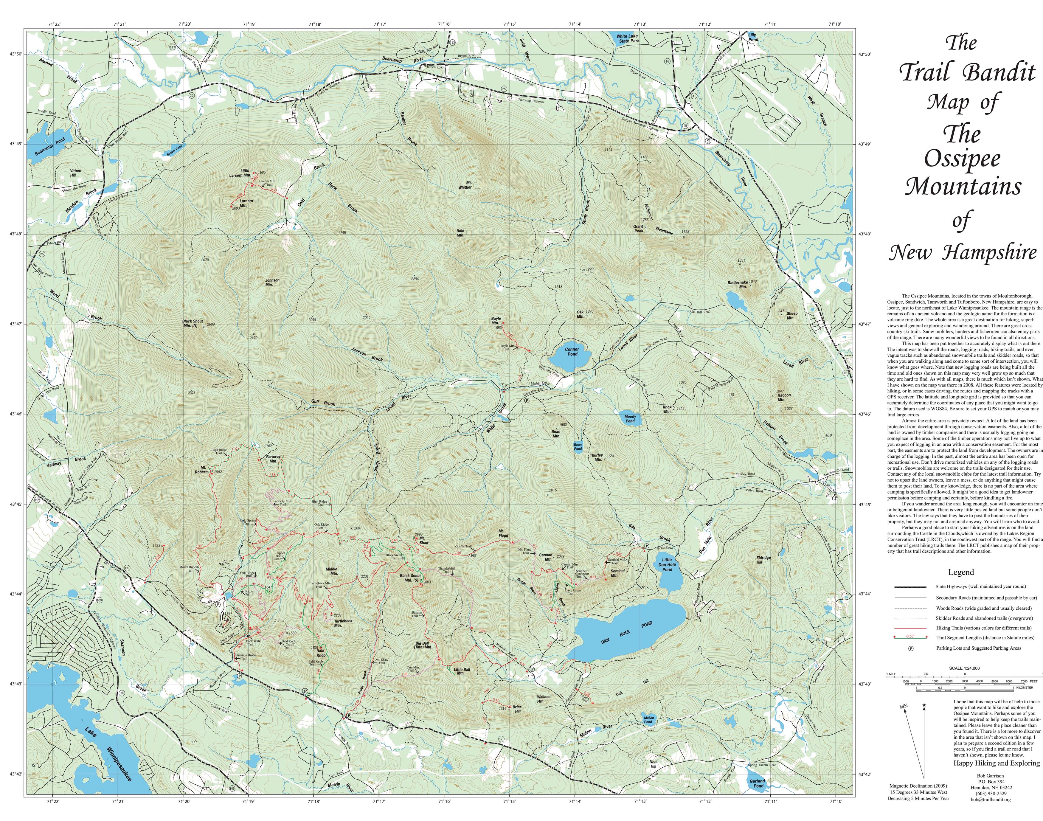
This is Robert Garrison's excellent hiking map of the Ossipee Mountains - only now in Garmin GPS image file format.
If you have Google Earth installed, you can “drape” Robert Garrison's hiking map over the terrain by downloading one of the files Ossipee_Mountains_2009_lores.kml (low res 2.8 Mb) or Ossipee_Mountains_2009_hires.kml (hi res 7.4 Mb). This will call up Google Earth automatically (but may take a moment because of the size of the image file).
For fun, click on one of the peaks, such as Mt. Shaw, and select “Fly on a Tour”. You may also want to control the opacity of the image overlay using the ‘Adjust Opacity’ slider.
You can instead download just the hiking trail layer Ossipee_Mountain_Trails.kmz.
For Google Maps, paste the URL http://csail.mit.edu/~bkph/Maps/Ossipee_Mountain_Trails.kmz into the “Search” box.
Extract of Lakes Region Conservation Trust (LRCT) map of Protected Lands in the Ossipee Mountains (2003)

Legend of Protected Lands:
441 Thompson - LRCT
442 Thompson - LRCT
443 Castle Springs - LRCT
444 Chellman - LRCT
90 Hackett Hill Wildlife Management Area
91 Perkins
94 Thompson #1 (Watson Pasture)/Kimball
95 Thompson #3/Sanger Brook Inc
97 Retsof/Chocorua Forestlands
98 Thompson #2/Chocorua Forestlands
100 White Lake State Park
102 West Branch Pine Barrens
109 UNH - Lord Farm
110 Bearcamp Memorial Forest
115 UNH - Lovell River
166 Garland Pond Wildlife Management Area
176 Dan Hole Pond Conservation Area