Attribute Analysis of Geo-tagged Images
Bolei Zhou1, Liu Liu2, Aude Oliva1, and Antonio Torralba1
1Computer Science and Artificial Intelligence Laboratory, 2Department of Urban Studies and Planning,
Massachusetts Institute of Technology.
[PDF][Supplementary Materials][Database][PerceptionMap][City Attribute Images][City Identity Images]
1. Introduction
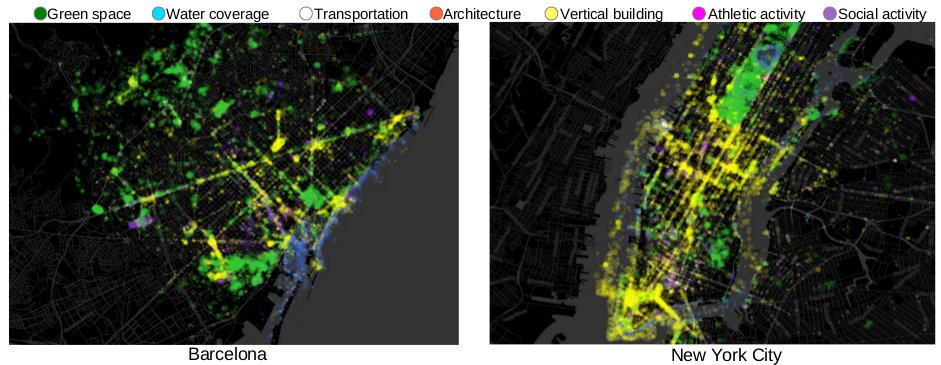
After hundreds of years of human settlement, each city has formed a distinct identity, distinguishing itself from other cities. In this work, we propose to characterize the identity of a city via an attribute analysis of 2 million geo-tagged images from 21 cities over 3 continents. We build a higher-level set of 7 city attributes, tailored to the form and function of cities to represent the geo-tagged images. The following is the estimated attribute distribution map, called perception map.Perception map of Barcelona and New York City [More]
2. City Perception Database
More than 2 million geo-tagged images from 21 cities across Asia, Europe, and North America. Following are images with salient city identity values in the city attribute of transportation and architecture in our dataset: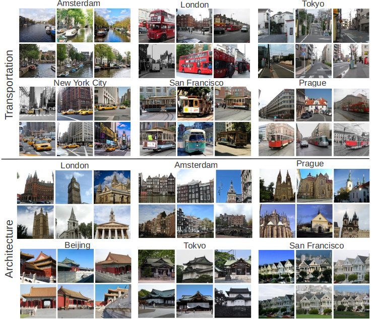
3. Reference
Bolei Zhou, Liu Liu, Aude Oliva, and Antonio Torralba. "Recognizing City Identity via Attribute Analysis of Geo-tagged Images." In Proceedings of 13th European Conference on Computer Vision (ECCV 2014)