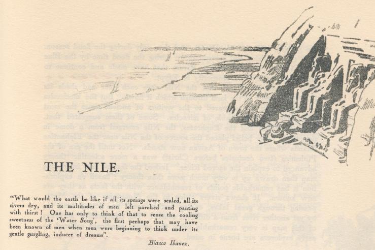
Many centuries ago Herodotus described Egypt as "the gift of the Nile". Herodotus was right. Were it not for the Nile, what is now Egypt would be a waste of desert from her western frontier to the Red Sea. Other countries are watered by rivers. Few others can claim, as Egypt can claim to be the valley of one river; a narrow valley across which, in many parts of the country, the outlying edges can both be seen at once by an observer standing in the middle. Save for occasional oases it is only in the Delta that the valley of the Nile branches out. In Upper Egypt the average width of the valley is no more than seven or eight miles. And yet this narrow valley gives life and prosperity to human beings in Egypt and the Sudan. The great Nile has two sources, one near Lake Tanganyika, the other in the highlands of Abyssinia. Its main tributary, the White Nile, rises in the watersheds of Lake Victoria, and journeys over 2,000 miles through forest and swamps before it is joined by the Blue Nile. The combined waters then pour into the main stream nearly 1,000 miles south of Egypt's border. In this long stretch of desert only one tributary, the Atbara, adds to Nile Waters and then only during the flood season. It is the fertilizing soil brought down during the flood time by the Blue Nile, White Nile and Atbara Rivers that have made and continue to make the fertility and prosperity of Egypt.  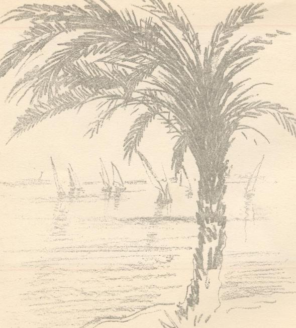 Today we know that the Blue Nile and the White Nile, in proportions which vary according to the seasons, are the factors which determine the output of the main stream. If there were only the Blue Nile, Egypt would receive a Hood of water between July and October, for during these months it contributes 67% of the 33,5 milliards of water brought to the parent stream. For the rest of the year however its contribution falls to 28%. If there were only the White Nile the valley of the Nile would be parched during the summer months. As the old phrase runs : "The White Nile makes the Nile and the Blue Nile makes Egypt", It is in June that the waters of the Nile are at their lowest point, And then, slowly at first but with increasing rapidity the bounteous rise begins. Ancient inscriptions record hymns of praise to this harbinger of fertility which poets of long ago ascribed to the tears which Isis had let fall into the River. As days pass and the waters rise the flood swirls and swells, and in
ancient times, overflowing its banks inundated the land. When the floods
had abated and the river had returned to its bed a layer of rich fertilising
deposit was left on the uncovered land. On this the peasant sowed his seed.
While this routine can hardly be called an irrigation system it had at
least the merits
The flood varies in intensity; in ancient times there were years of plenty and years of famine, There were also years when, passing from benevolence to destruction, the flood was so great as to become a calamity. Ancient historians tell us something of the anxiety with which, through the ages, dwellers in the Nile valley watched for the coming of the waters, They tell of the joy with which were hailed the little crocodiles washed down from their southern homes to the waters of Egypt. They tell of the various stages of the flood and of the solemn moment when the water reached the top of the banks. They tell of the prayers, the ceremonies, of the cry "Hail o river that comest to give life to Egypt". The simple succession of flood, sowing and harvest must have lasted for many centuries, But the urge for preservation against drought and devastating Hood caused the ancient Egyptians to seek methods for the guidance and control of the river, hoping thus to lessen the hardships of lean years and spare the land from further inundation. They dug channels across the higher lands immediately flanking the river to carry water to the lo,v lying lands beyond. They erected a series of cross banks to prevent the water flowing northwards in which direction the land naturally slopes. This was the origin of what is known as the basin system of irrigation. These cross banks however were several times destroyed by high floods and King Menes (of the First Dynasty) ordered the construction of banks along the Nile to keep the river within bounds. Such an enterprise, even in those days of cheap if not compulsory labour, was colossal in its magnitude. Even King Menes failed to carry it through. Of the two banks which he decreed only one, that on the left side, was erected. The right bank was left to the mercy or fury of the flood. Centuries later King Sesostris decided to complete the work of Menes and, by a stroke of genius saw in the depression of Lake Moeris an overflow for excessive flood waters and a reservoir which could store them for future use. By connecting the river with Lake Moeris Sesostris did more than create storage for Nile waters for, around the Lake thus aggrandized, grew up the fertile Province of Fayoum. Gradually the whole countryside was divided by a network of banks into communicating basins. This system of basin irrigation prevailed in Egypt until the 19th century. At the time of the Arab Conquest (A.D. 640) Upper and Middle Egypt were divided up into several basins. The Delta, under the same system, was divided from its apex to the sea by six branches of the Nile, which filled the basins during flood and drained them later. The Arab rulers did however much valuable work in the realm of irrigation. All along the banks of the Nile they erected gauges indicating the levels of water at different stages. Readings on the Nilometer at Roda near Cairo go back to the beginning of the 8th century. At that time the area under cultivation was in the neighbourhood of one and-a half million acres. This figure rose, still under Arab rulers, to three million acres supporting a population of 12 millions. Two factors were, in the 19th century, to revolutionize the control of Nile waters. One was of Mohammed Ali, founder of the the other was the introduction of the cotton plant brought to Egypt from Brazil and India in 1830. Nile soil can produce the finest cotton in the world. Under the basin system however the cotton plant suffers from lack of water. It must be planted before the Nile begins to rise, it requires frequent waterings and its maturity corresponds with flood time. Mohammed Ali having decided to grow cotton set about to find the means whereby it could be grown. He ordered the embankment of the Delta branches of the river, the digging of deep canals to conduct the low level waters of the summer to the neighbourhood of the land under cotton and to protect these lands from inundation during flood. Regulators were built to hold up and raise the level of low water and bring it within a reasonable lift for irrigation by means of pumps. Cereals were sown in November after the flood had subsided and after the harvest in April canals were cleared for the passage of summer water to the land under cotton. This was the origin of perennial irrigation in Egypt. - But it was laborious and costly. Mohammed Ali therefore called upon his engineers to devise a more practical method of raising the level of the low summer water. Their studies and reports led to the construction of the Delta Barrages. Work thereupon was started in 1843 and was not completed until 1861. It brought a million acres under cultivation. From that time Egyptian irrigation has made constant and enormous strides. Under the Khedive Ismail, the Ibrahimia Canal, one of the largest artificiaf channds of the world, was dug. Such great benefits had accrued to Lower Egypt from the cultivation of cotton that Middle Egypt followed suit and it soon became evident that further water storage would be necessary if cotton cultivation were to take its rightful part in the economy of the Egyptian nation. An International Commission was consulted and it was decided to erect a dam in the neighbourhood of the Aswan cataract. This was completed in 1902 but the desire to spare the Temple of Philae led to its storage capacity being reduced below the figure originally contemplated (a decision subsequently rescinded by the heightening of the dam). Its first storage capacity was nearly one milliard of cubic metres, By 1903 the agitation regarding the submersion of Philae Temple had somewhat abated in view of the Government's undertaking to strengthen the Temple's foundations. The capacity of the dam was then increased to two-and-a-half milliards of cubic metres by raising its height to 27 metres. The work was completed in 1912 and in 1928 a further heightening was undertaken. This was completed in 1933. The total cost of the Aswan Dam exceeds nine million pounds. Other great Barrages on the Nile are those of Assiut, Zifta, Esna, Nag-Hamadi. These are in Egypt proper but, for the benefit of the Egyptian cultivator, a giant dam has also been erected at the confluence of the Blue and White Niles, just below Khartoum. Known as the Gebel Aulia Dam its construction began in 1933 and was completed in 1943. The construction of further dams at Lake Tsana and Lake Albert are probable developments of Egyptian irrigation. The present plans of the Egyptian Government with regard to the control
and distribution of Nile waters are extensive, enterprising and far reaching.
Several of them involve planning fifty and sixty years ahead and of the
schemes now under study several cannot materialize until the 21st century
has dawned, The thoughts of Egyptian irrigation engineers, like those of
youth, are "long, long thoughts", They need to be, They deal with a long
long river and with the welfare of the people whose ancient origin is lost
in the long mists of time.
|