| Size, bytes | Filename | Description
|
| 227,430 | aengliff.jpg
| Sue and Sue peer over the 70m limestone cliff in the first ring of Dun Aengus. The west coast of Inishmore is visible in the background
|
| 144,015 | aengulee.jpg
| Lee sits on a rock above the same cliff. It felt solid at the time. The inner wall of Dun Aengus is in the background.
|
| 129,125 | aengus.jpg
| Sue and Sue peer over the cliff at Dun Aengus.
|
| 79,317 | aengusbk.jpg
| The inside of Dun Aengus looking south over the Atlantic.
|
| 265,106 | biatwins2.jpg
| The dock at Rossaveel. Ferry Discovery in background.
|
| 65,818 | brand00.jpg
| The road just before Brandon Head. Clogher Head on the left.
|
| 84,480 | brandon.jpg
| Looking west back toward Ballyferitter and Brandon. The sun is behind the rain.
|
| 109,205 | cheek.jpg
| SueP looks out over the Atlantic from 1st ring of Dun Aengus.
|
| 63,518 | clarecas.jpg
| A ruin of a castle (1.25 walls) stand in a field outside of Ennis.
|
| 217,963 | claresue.jpg
| SueF rides down a winding hill outside of Ennis.
|
| 168,995 | clifden.jpg
| The alley in the middle of the Clifden town square. The cathedral spire is in the background.
|
| 212,877 | clochan.jpg
| The Clochan on Inishmore. Sue and Lee crouch in doorway.
|
| 95,281 | crumpisl.jpg
| Crump Island is in the background as SueP rides up a steep road after Rinvyle castle.
|
| 47,606 | darcybb.jpg
| Last morning. Getting ready to ride to Shannon. The front of the B&B.
|
| 115,091 | dingbow2.jpg
| Looking east from the shed on Dunmore Head at the double rainbow. Significant processing done to picture.
|
| 67,451 | doolinbb.jpg
| Bikes parked on the south wall of the B&B at Doolin.
|
| 61,557 | doolisle.jpg
| The small island which protects the rocky harbor of Doolin. Taken from Doolin dock. Note small stone hut.
|
| 120,350 | dooland.jpg
| Looking south back at the surf breaking over Doolin's island with the Cliffs of Moher in the background.
|
| 78,593 | door-typ.jpg
| On the low road of Inishmore. |
| 132,891 | dunmorsl.jpg
| The face of Dunmore Head (the end of Dingle peninsula) from Slea Head. The shed is barely visible and the ship wreck less so. dunmorh.jpg looks along cliff.
|
| 117,140 | dunmorh.jpg
| The classic jagged shore postcard: view E along Dunmore Head. The Blasketts disappear into the mist (rain shower is heading our way).
|
| 88,083 | dwindwav.jpg
| The wind blowing the surf on the small island in Doolin harbor. Taken from the ferry.
|
| 125,063 | fermsbow.jpg
| Mom and Sue duck from the wind on the bow of the Happy Hooker. Note the water on their backpacks.
|
| 146,417 | ferrwave.jpg
| Muriel and SueP duck as a wave splashes over the rail of the Discovery between Kilronan and Inishmaan.
|
| 141,023 | fersmall.jpg
| SueP in the stern of the first ferry (Tranquillity) from Doolin to Inisheer.
|
| 81,755 | fourstor.jpg
| SueF at the four story castle at Gallarus.
|
| 42,144 | gortnag2.jpg
| Recent buildings in Gort na gCapall, Inishmore
|
| 24,124 | gortnagC.jpg
| Old buildings in Gort na gCapall, Inishmore.
|
| 253,996 | happyh.jpg
| SueP on the Inisheer dock in front of the Happy Hooker.
|
| 380,448 | inchding.jpg
| Sue and Sue on the beach (strand) of Inch. The Dingle peninsula is in the background.
|
| 271,736 | inchkerr.jpg
| Sue and Sue on the beach (strand) of Inch. The ring of Kerry is in the background.
|
| 43,879 | kiluplog.jpg
| Looking over Upper Lough toward Moll's Gap.
|
| 36,724 | kitten.jpg
| SueP and a calico. |
| 131,142 | kyleloug.jpg
| Looking south over Kylemore Lough and the verdant mountains behind it.
|
| 26,794 | lahilisc.jpg
| Lahinch and Liscannor from the Cliffs of Moher.
|
| 135,328 | lehinch.jpg
| Lee's first touch of the Atlantic in the old world. Liscannor and beginning of Moher Cliffs in background.
|
| 128,319 | limefrac.jpg
| A close up of the fractured, dissolved limestone crust which forms the Arans. Just west of the Inisheer lighthouse.
|
| 30,039 | liscabay.jpg
| Liscannor Bay from the Cliffs of Moher. |
| 314,176 | meerabby.jpg
| The abbey on Inisheer. |
| 85,639 | meerlths.jpg
| The lighthouse and freighter hulk on Inisheer as seen from the ferry from Doolin.
|
| 194,387 | meerltsu.jpg
| SueP poses with the Inisheer lighthouse in the background.
|
| 258,366 | meerrock.jpg
| SueP on the rocky shore west of the lighthouse on Inisheer.
|
| 238,822 | meerwall.jpg
| Looking west from the top of Inisheer. |
| 186,707 | mohercow.jpg
| Cattle in a field by the side of the road along the Cliffs of Moher, just south of the visitor's center.
|
| 72,234 | mohedge.jpg
| Sue Payette looks over the cliff edge at the spike.
|
| 130,323 | mohergeo.jpg
| Sedimentary layers at the Cliffs from O'Brien's Tower.
|
| 76,457 | mohsmoke.jpg
| The cliffs burn just below O'Brien's tower.
|
| 93,273 | mohspike.jpg
| Looking down on the spike at the point (tower behind us).
|
| 55,934 | mohspkbs.jpg
| The south west corner of the base of the spike is missing.
|
| 84,410 | mohtower.jpg
| O'Brien's tower at the top of the Cliffs of Moher.
|
| 87,540 | mohvib.jpg
| Lee standing on the vibrating stone at the edge backlit by the sun with the cliffs in the background.
|
| 161,212 | molllesu.jpg
| Looking south at Moll's Gap. |
| 20,381 | morecow.jpg
| A matched pair of cow in a corral at An Sruthian, Inishmore.
|
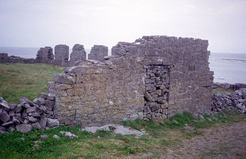
| 120,947 | moredoor.jpg
| A ruined barn(?) on the north coast of Inishmore.
|
| 202,767 | morels.jpg
| Lee and Sue in the ruined barn(?). Galway Bay to the north.
|
| 204,768 | morepose.jpg
| Lee and Sue in the ruined barn(?). Galway Bay to the north.
|
| 33,358 | mudstone.jpg
| Detail of worm tracks in mudstone slabs used as fencing at Cliffs of Moher. These slabs are about half a meter high and two meters long.
|
| 203,081 | panzert.jpg
| The second ring at Dun Aengus with the jagged stones beyond. Looking NW.
|
| 155,088 | quinabby.jpg
| The Abbey at Quin. |
| 73,923 | quinview.jpg
| Looking west from the Abbey at Quin. |
| 114,378 | rinstair.jpg
| Detail of the spiral stair of Rinvyle castle.
|
| 152,733 | rinvyle.jpg
| The inside of Rinvyle castle. |
| 101,850 | skyjack.jpg
| Mom and Jack eating lunch on the north side of the north fork of the Sky Road.
|
| 98,387 | skytops.jpg
| SueP at the top of the Sky Road. Talbot Island in background.
|
| 154,689 | sleapin.jpg
| SueF crosses the stream in a hairpin on the south Slea Head road.
|
| 137,182 | sleanor.jpg
| Looking N from Slea Head. The beach is visible.
|
| 135,958 | sleax.jpg
| SueP pays respect at Slea Head. |
| 374,628 | tralee.jpg
| Sue and Sue stretch in front of the Royal Liver Assurance office on Denny Street in Tralee.
|
| 156,249 | tullylak.jpg
| Jack and SueP ride down Tully Mountain with Tully Lake on the left and some of the Twelve Bens in the background (the east).
|
| 110,462 | wormlee.jpg
| Lee sitting on the rocky "shore" at the Worm Hole with the Atlantic breaking in the back.
|
| 92,373 | wormsue.jpg
| SueP watching the Worm Hole. |
| 9.1 MB
| | 71 files. |