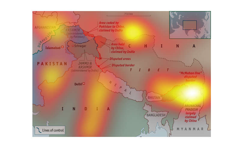
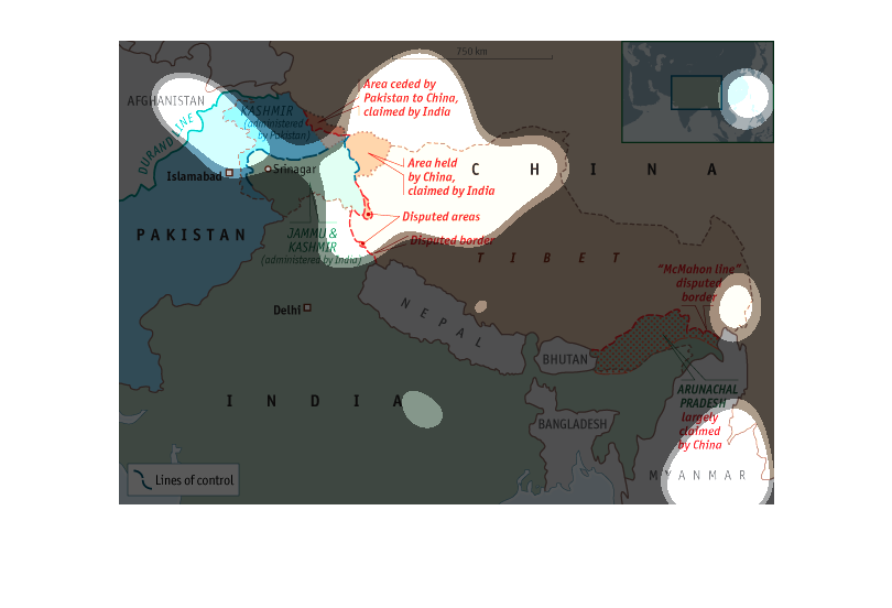
This is a map of Inia, China, Nepal, Myanmar, and Afganistan, and a few others. This shows
dispute lines between different countries. Most of the dispute lines include China. The lines
represent countries territories that are not one or the others' and are argued over.
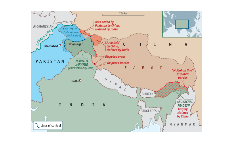
This is a map of the east. It shows China, Tibet, Indonesia, India, and Pakistan. It also
shows the border of China and how politics govern the border.
This is a geographical map showing some contested border lines in Asia. Included on the map
is an area held by China, claimed by India and various other disputed border regions.
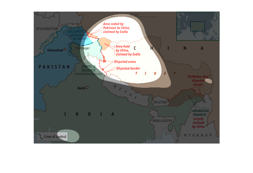
A map of Asia that shows countries like Pakistan, Islamabad, India, and other countries in
a map tp show what the relations are between the countries.
The imagine is a map that contains areas such as the Middle East, China and India.  The maps
highlights the lines of control China has over these areas.
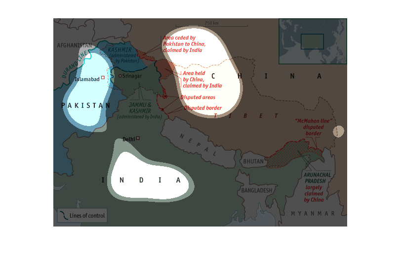
This is an image of China, Pakistan, and India. It shows areas that are in dispute between
the nations. An area by Pakistan was ceded to China but claimed by India. An area by India
is also being disputed.
The image is a map of the Far East, identifying major countries and areas of disputed land
or parts of counties that are claimed by other countries.  The countries of China, Indian
and Bangladesh are identified..
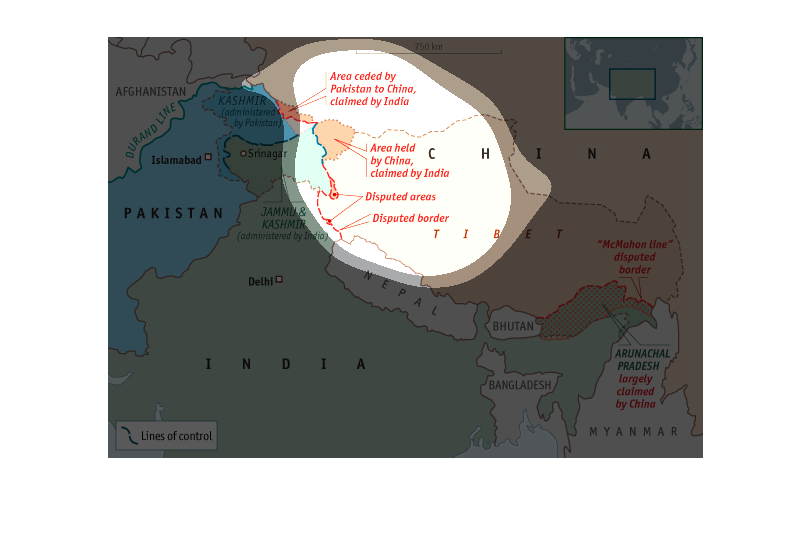
This chart displays a map with outlined red, dotted lines that indicate that an area is either
being disputed over or is under the control of some nation.
Appears to be a map of some sort. Show cases the lines and different areas of where countries
are divided and where that land belongs to. Colors are also used to emphasize this.
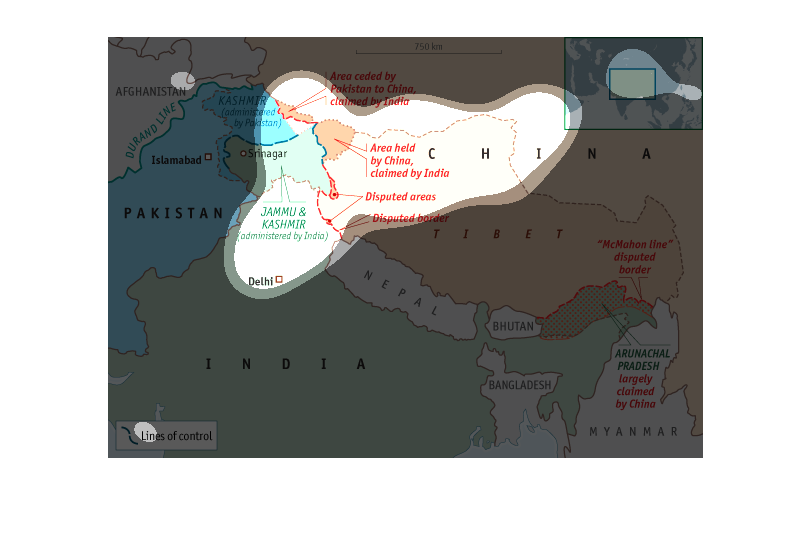
A colorized map of middle eastern countries such as Afghanistan, Pakistan, India, and so on.
The largest part of the map consists of China, and shows some contested areas between China,
India, and Pakistan
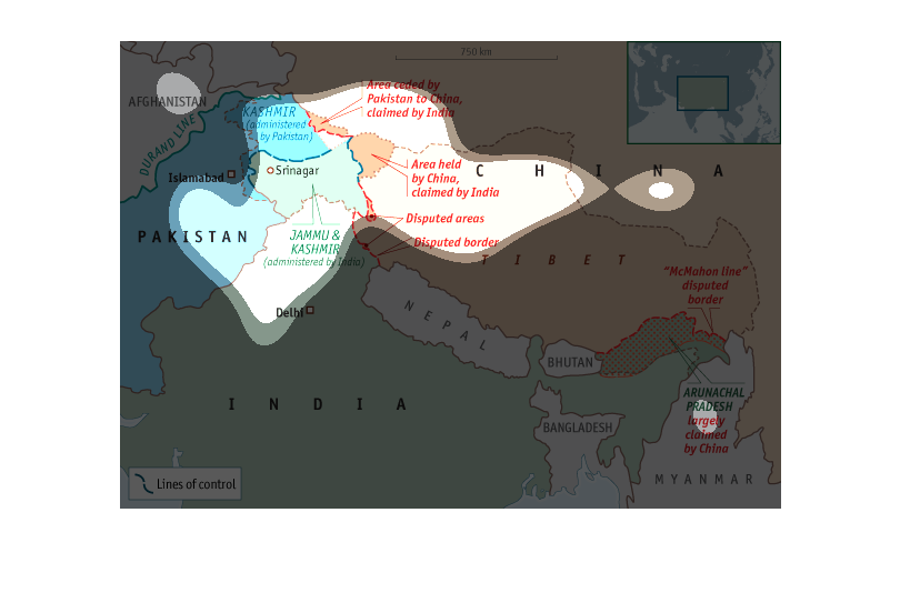
The map depicts area of the Eastern land and territory control.  Majority of the land are
owned by China but India are in control. As further west you go the rest are belong to middle
eastern
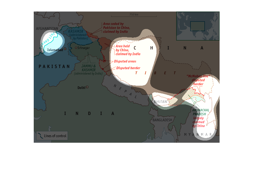
This map shows part of the Middle east, China, India, and part of Myanmar. It is a map to
specific the borders for each country. In china it says it is an area held by China claimed
by India.
The image is a map of China and its surrounding countries. It includes lines of control around
each country, as well as limited historical information as to the historical ownership of
certain locations.
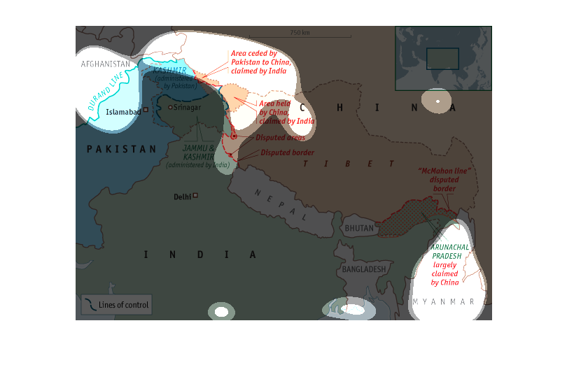
This image is a map of the middle east. The map also gives some descriptions of events that
have taken place in those areas. Some of the areas include Afghanistan, Pakistan, Delhi and
Tibet.