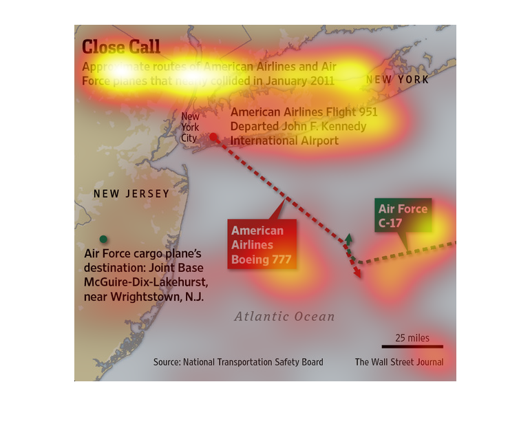
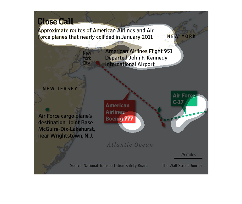
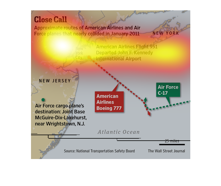
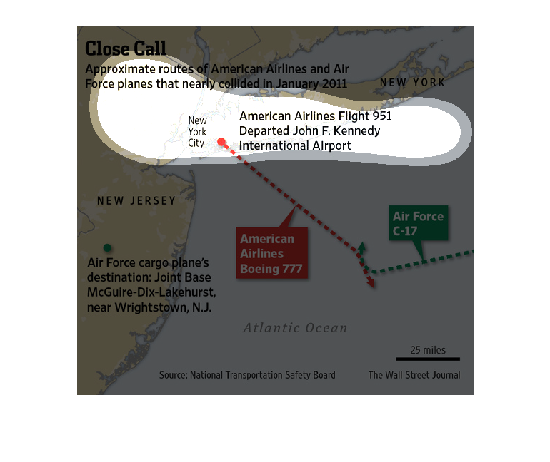
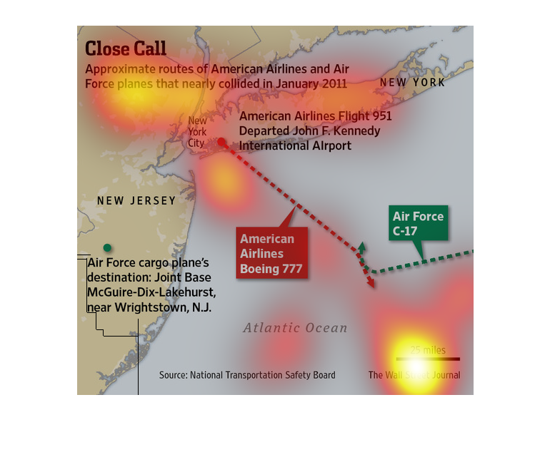
This is a map and diagram of the Northeastern U.S. with related statistics depicting a near
collision between Air Force planes and an American Airlines flight.
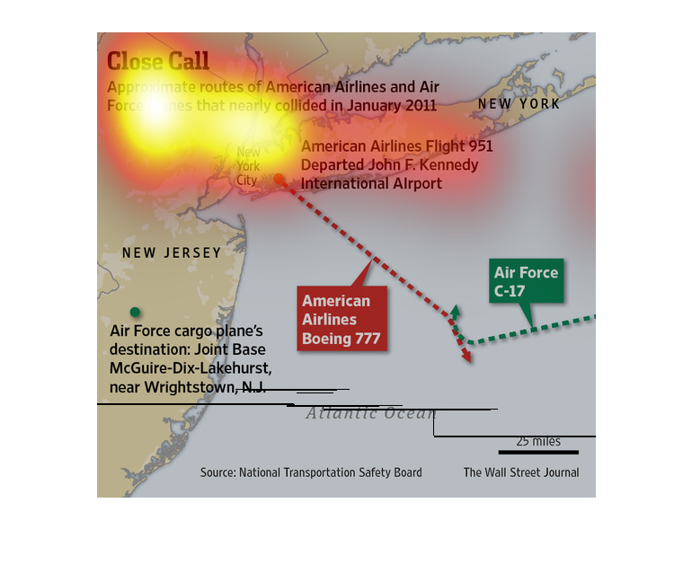
This graph shows the routes of American Airline planes and Air Force planes that have nearly
collided in January of 2012.  It shows the projected paths of each plane and also where the
near collision occurred.  It also depicts the destinations of each plane. This chart was made
by the National Transportation Safety Board and published in the Wall Street Journal.  It
shows American Airlines Boeing  777 and Air Force C-17.
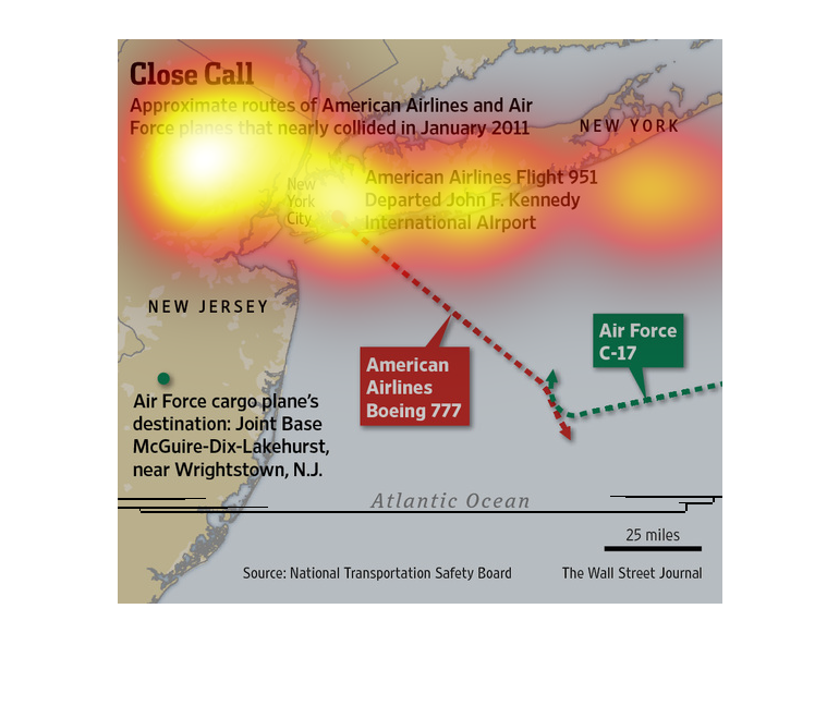
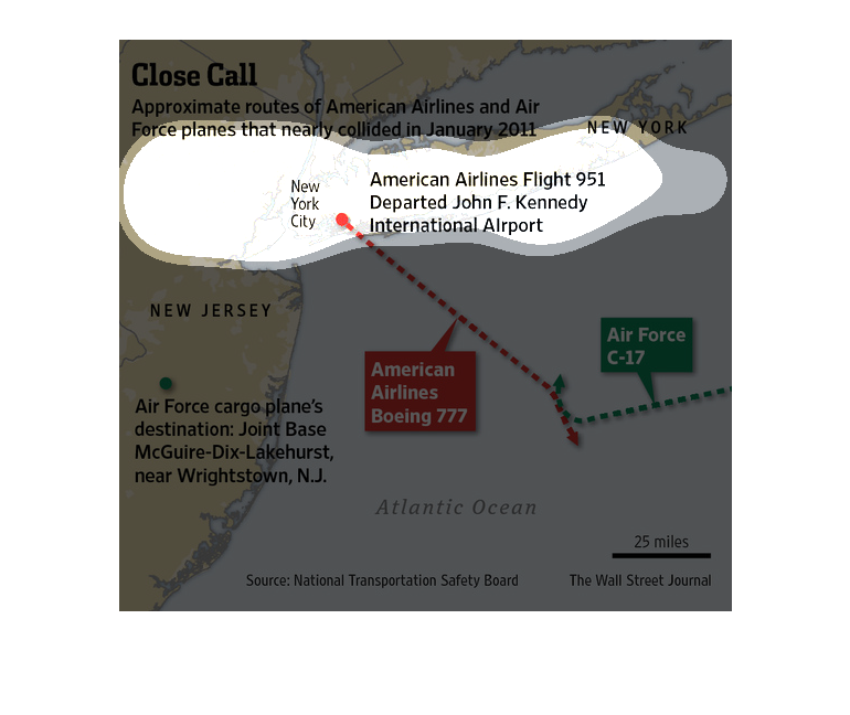
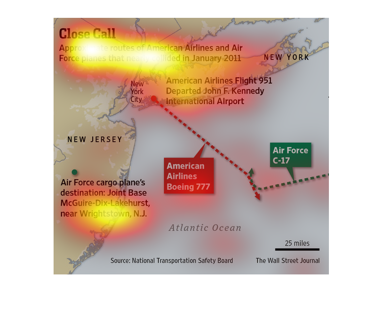
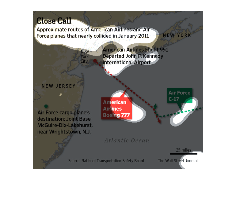
Close Call | Approximate routes of american airlines and air force planes that nearly collided
in January, 2011. We see a map, with a plane departure from JFK and a near collision over
the atlantic ocean.

This image shows the approximate route of American Airlines Aircraft and Air Force planes
which nearly collided in January 2011.  It shows AA flight 951 a Boeing 777 which took off
from JFK airport in NYC nearly colliding with Air Force c-17 over the Atlantic ocean.
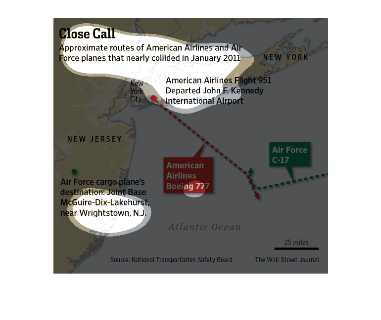
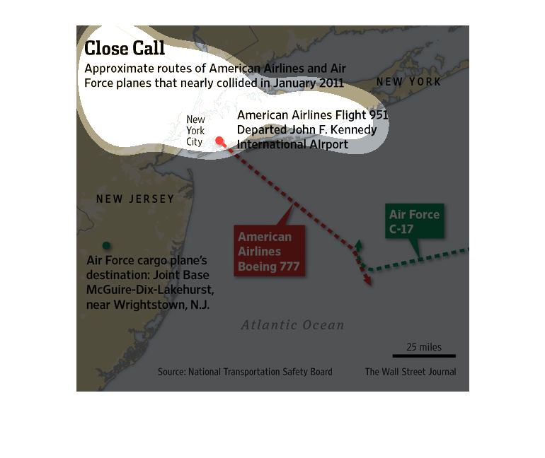
This chart describes close call. Specifically, approximate routes of American Airlines and
air force planes that nearly collided in January 2011. Categories are represented by different
colors.
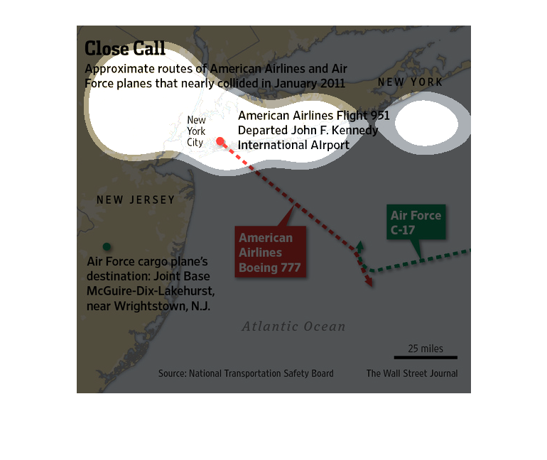
The caption for this map of NYC, surrounding states and the Atlantic Ocean is, "Close Call,
Approximate routes of American Airlines and Air Force planes that nearly collided in January
2011".  The map displays the flight paths of these two air craft and the approximate location
over the Atlantic Ocean where they almost flew into one another.
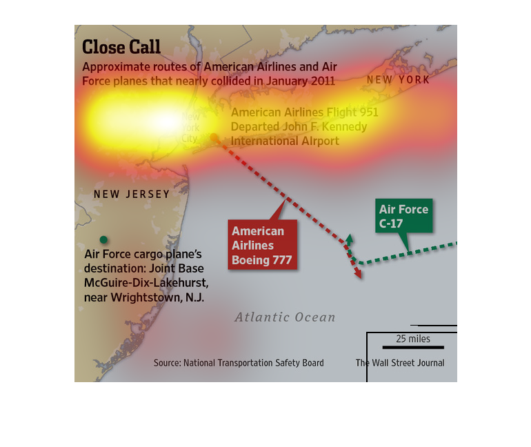
This chart from the Wall Street Journal shows how two planes, one from the US Air Force and
an American Airlines plane almost collided in 2011 over New York
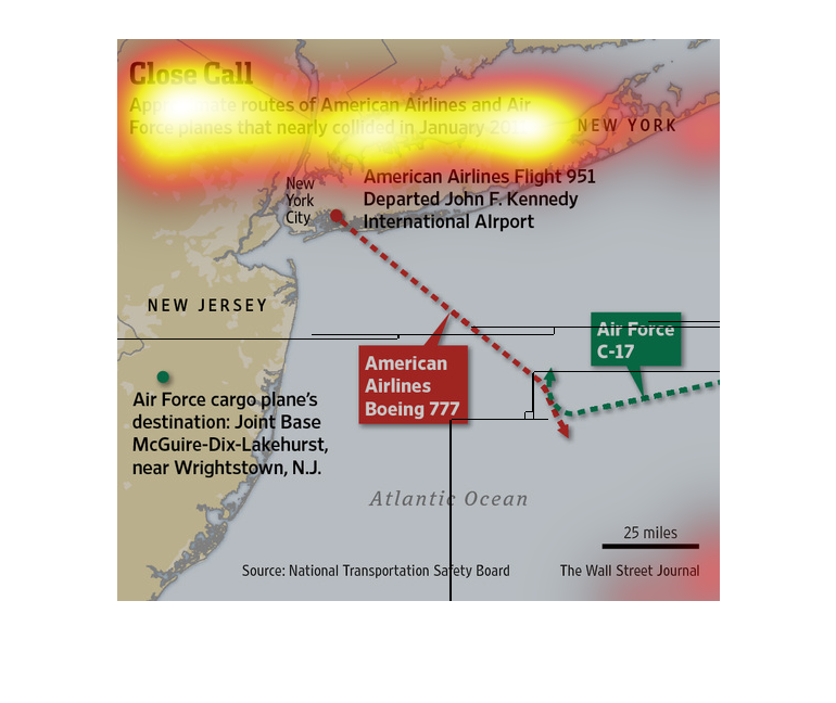
The image depicts approximate routes of American Airlines and Air Force planes that nearly
collided in January 2011. Problematic route is the route to and from New York City crossing
one-another over the Atlantic Ocean.
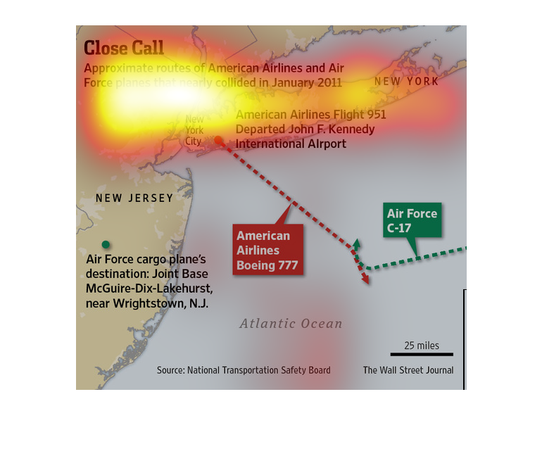
There's a map image showing New Jersey, New York and a good portion of the Atlantic ocean.
 Also pictured is the flight paths of one commercial passenger plane, and of an Air Force
air craft.  The graph displays a near miss of these two planes that took place back in 2011.
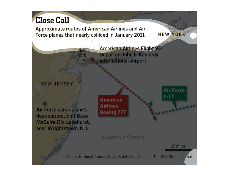
This chart describes close call. Specifically, approximate routes of American Airlines and
air force. Different categories are represented by different colors.
This chart shows the air flight paths of american airlines and air force plans which came
very close. It shows that it was close that they could of collided.
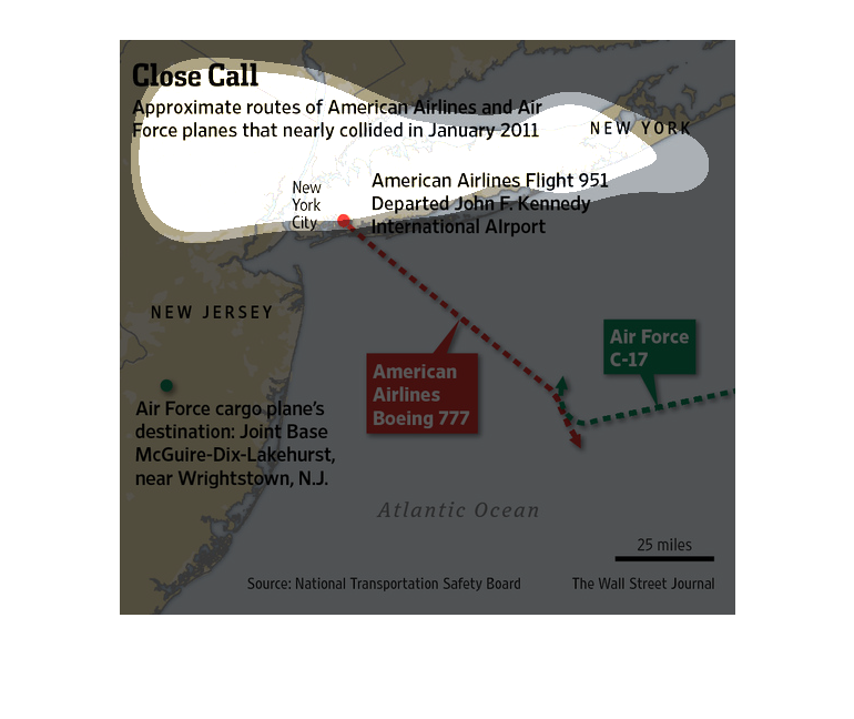
The image depicts the approximate routes for American Airlines and Air Force planes that nearly
collided in January. Crossing paths seems to occur east of New Jersey above the Atlantic Ocean.
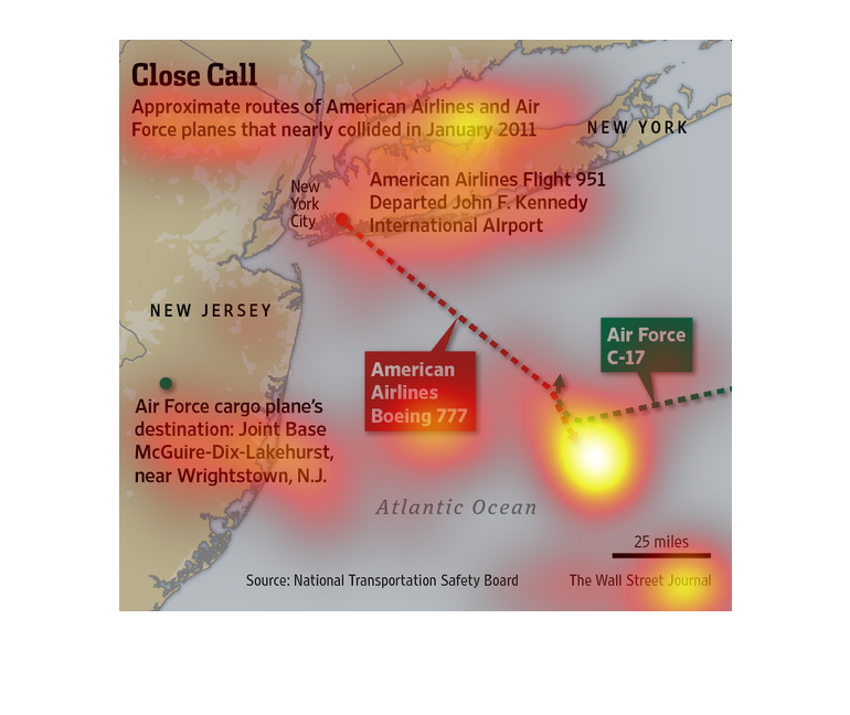
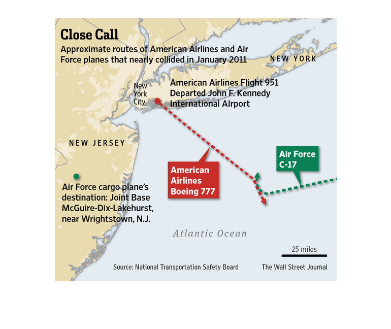
The chart shows the approximate routes of American Airlines and Air Force planes that almost
collided in January of 2011.  It shows that the American Airlines flight 951 departed JFK
Airport and the Air Force plane was destined for Wrightstown, NJ.

The image is from the Wall Street journal and depicts the routes of an Air Force plane and
an American Airlines plane that nearly collided in January of 2011. The near collision occurred
about 50 miles south of New York City and approximately 100 miles East of New Jersey.
This chart from the Wall Street Journal shows how a civilian airliner almost collided with
an Air Force jet outside of New york city in 2011.