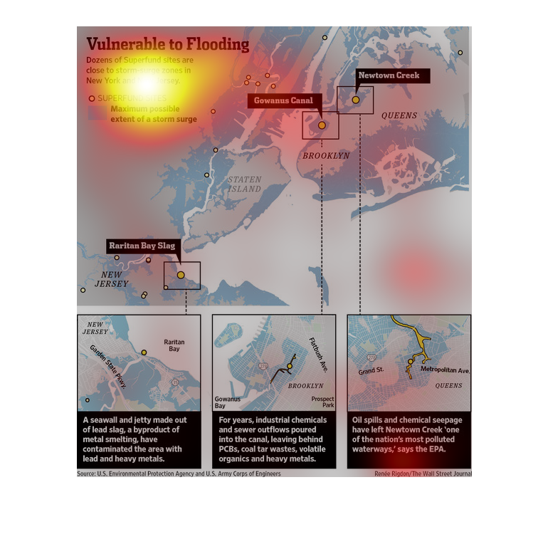
This chart describes vulnerable to flooding. Specifically, dozens of super fund sites are
close to storm surge zones. Categories on the chart include Newtown creek
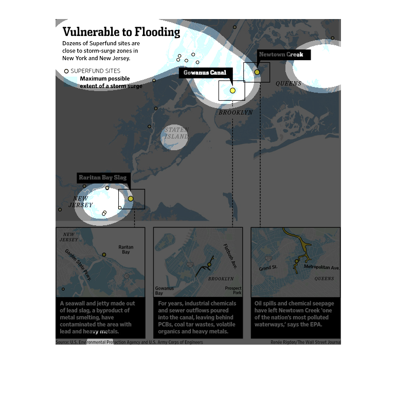
After the devastation that was hurricane Sandy, the losses were almost unbearable. Its been
a few years since it hit the city of New York, but as this illustration shows, it is still
vulnerable to flooding.
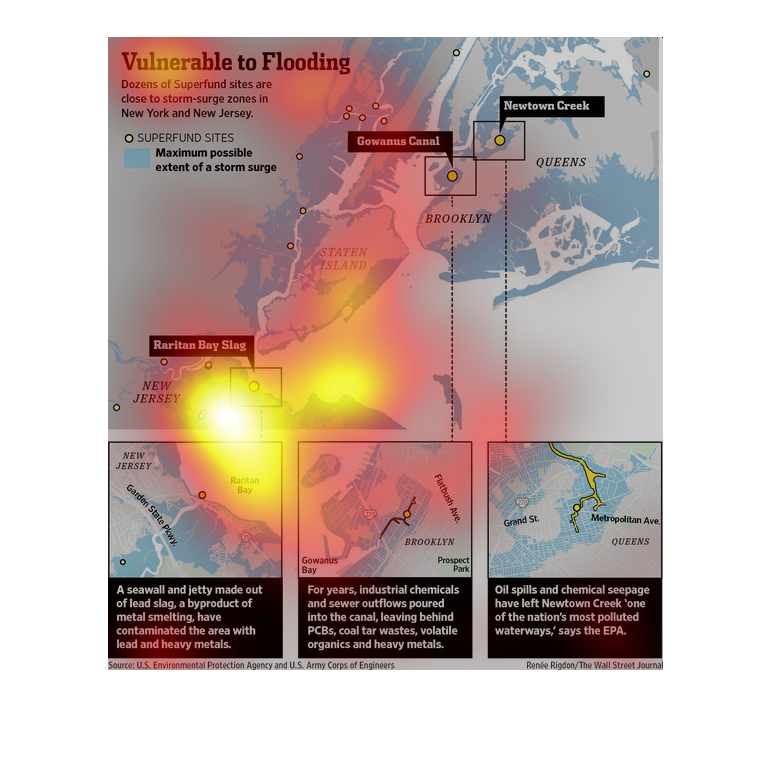
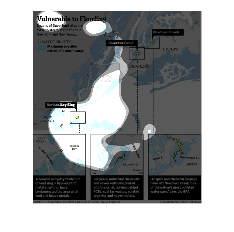
This chart from the Wall Street Journal shows how hurricane sandy threatened to flood superfund
sites in the new york city area and the risk it posed.
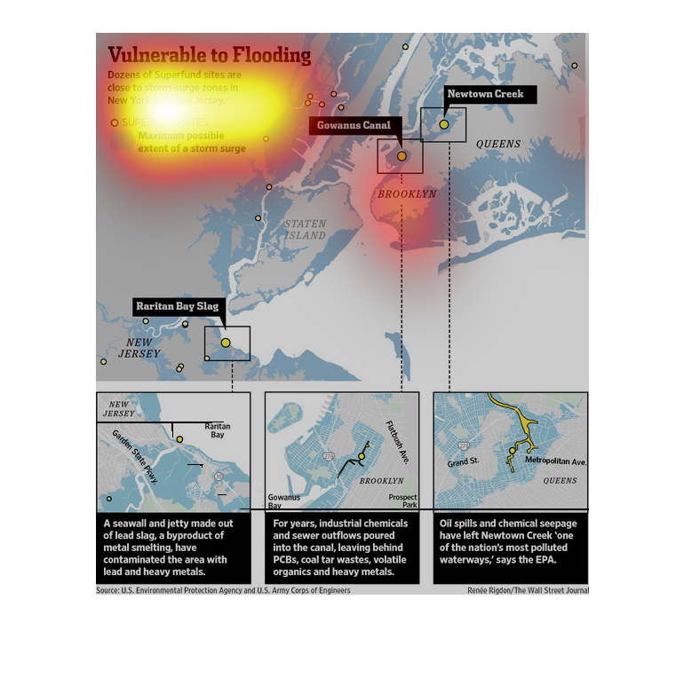
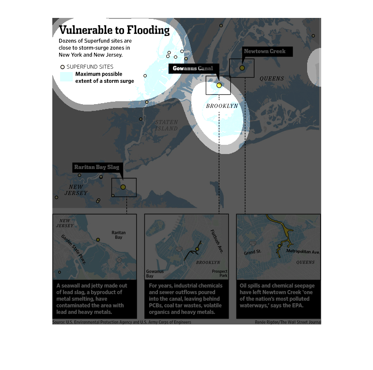
This a very important graph showing the vulnerability to flooding. It shows a map with a lot
of places with vulnerability. It is important so that people don't get flooded.
This is a useful chart showing a map and different areas that may be vulnerable to flooding.
It is helpful to know what areas are at risk here and it shows these.
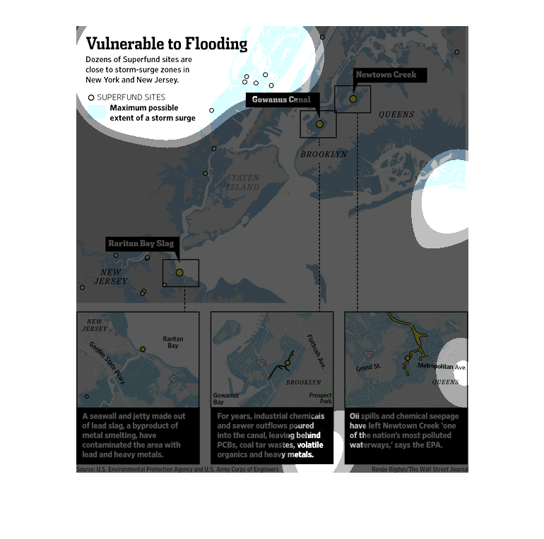
The image depicts how dozens of superfund sites are located close to storm surge zones New
York and New Jersey. The image depicts the susceptible sites and dangers to them by way of
natural disaster.
This graph is about the vulnerability, to flooding within New York and New Jersey.  From the
looks of it, the graph is putting in detail the dangers of a flood among the two cities and
the possibility of contamination within the water from many places such as oil spills; etc.
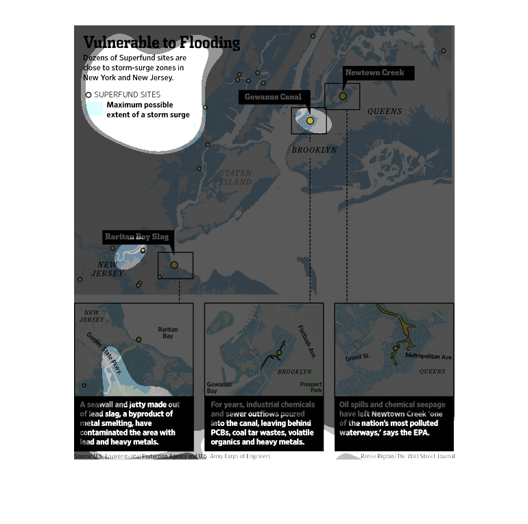
This chart from the Wall Street Journal shows how superfund sites in New York City area are
vulnerable to flooding as a result of superstorm Sandy.
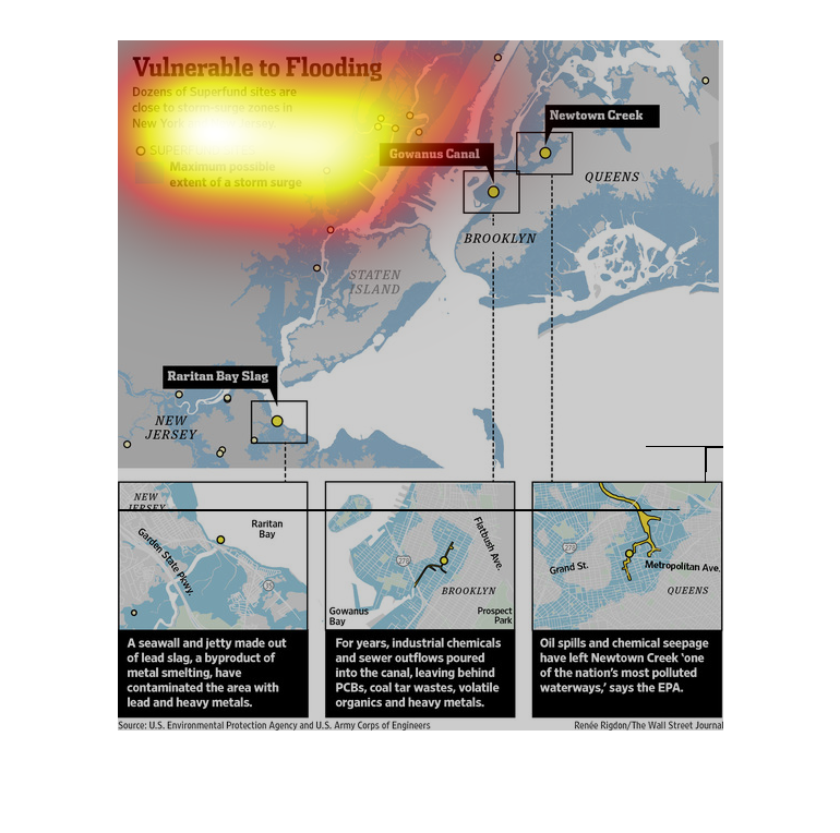
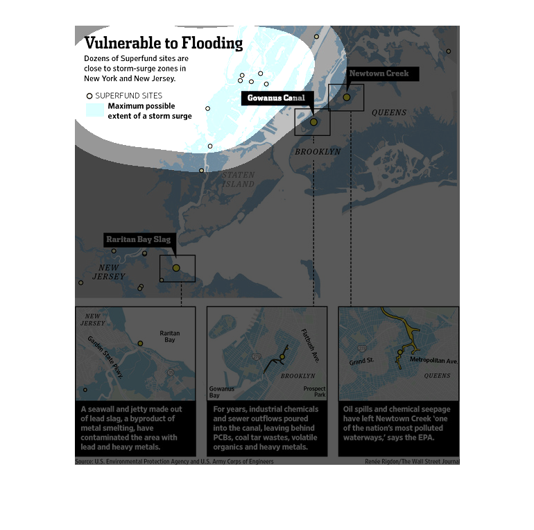
This chart describes vulnerable to flooding. Specifically, dozens of super fund sites are
close to storm surge zones in New York City and in New Jersey.
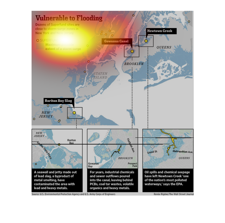
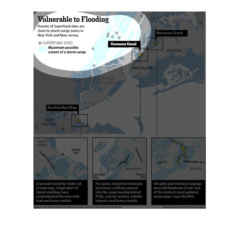
This shows how superfund sites are close to storm surge zones in New York and New Jersey.
 It has blowouts of the map indicating chemical spills and sewer outflows.
This image depicts a number of Superfund sites that also happen to be vulnerable to flooding.
Sites such as Newtown Creek in Queens is one such site. Another would be Gewannus Canal in
Brooklyn.
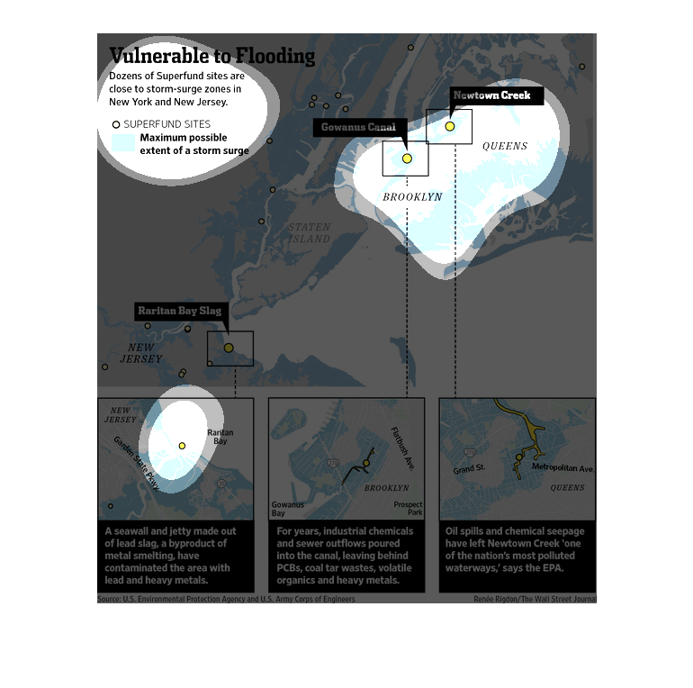
This is a map demonstrating that Superfund sites are closed to storm areas in New York and
New Jersey. Several zoomed in portions talk in more detail about these areas.
This image shows the Superfund sites that have a possibility of experiencing storm surges
or flooding in New York and New Jersey. Locations include Newton Creek and Gowanus Canal.
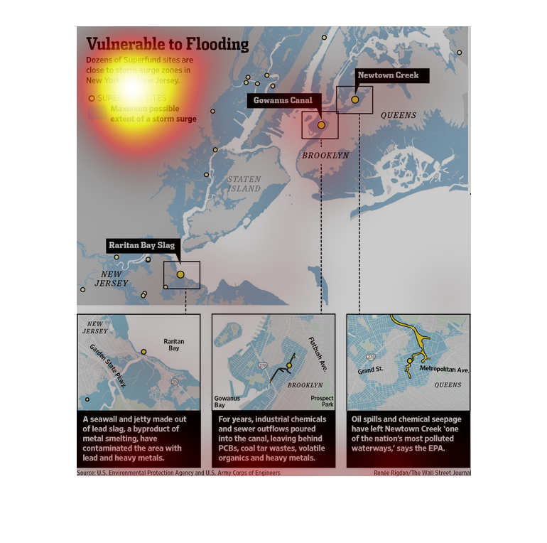
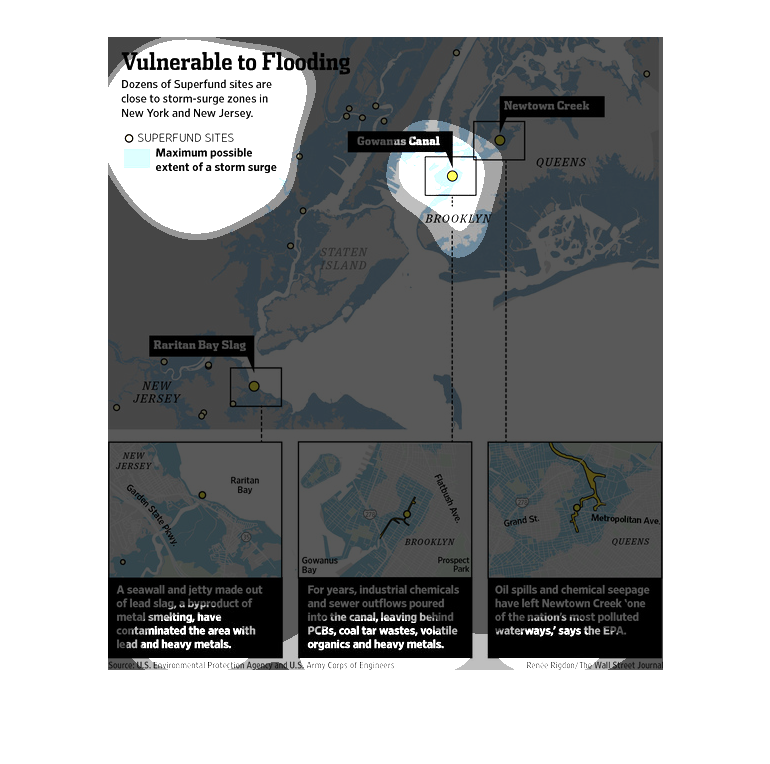
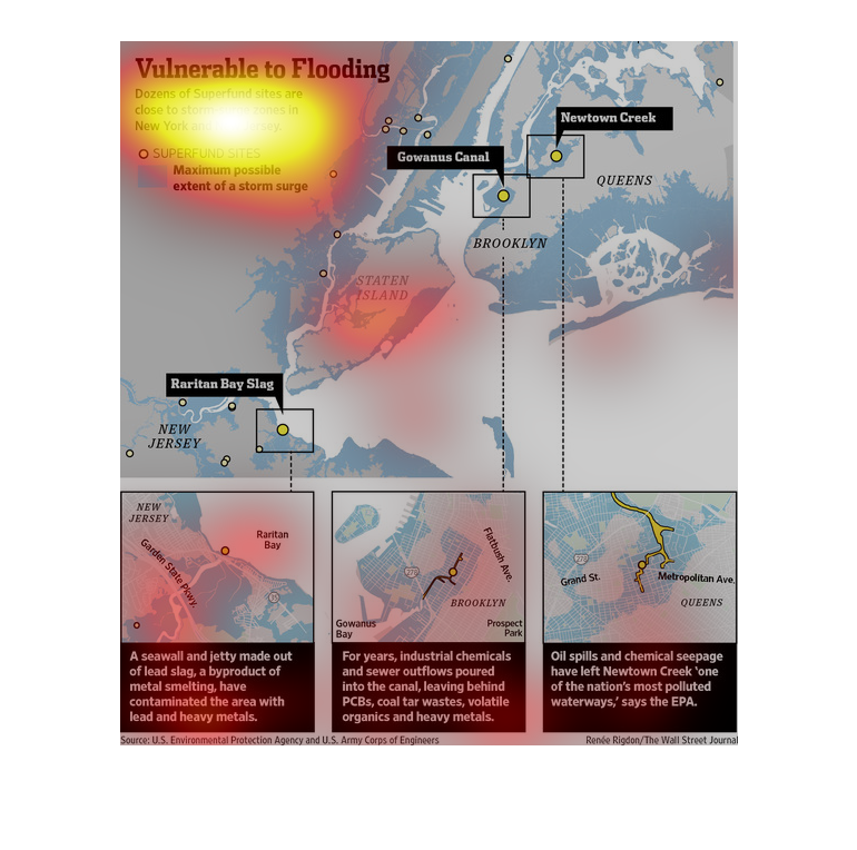
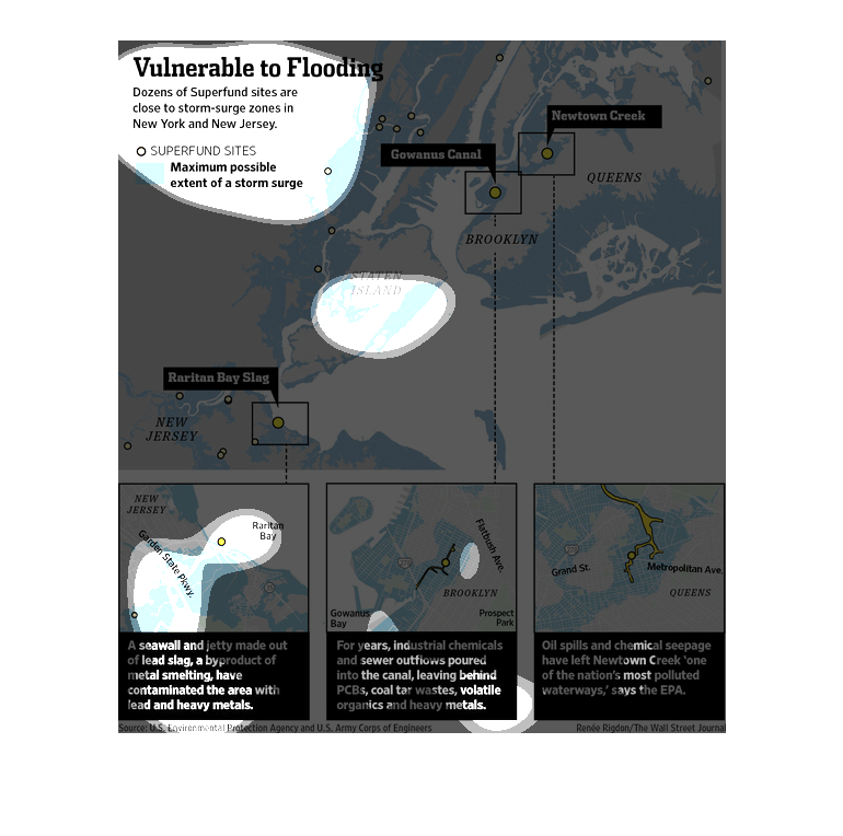
This model displays cities around and in New York and New Jersey that are vulnerable to a
flood from a storm surge. The maximum possible extent of the storm surge damage is also displayed.
Most, if not all of the areas that are vulnerable, are located on or along a lake or body
of water.