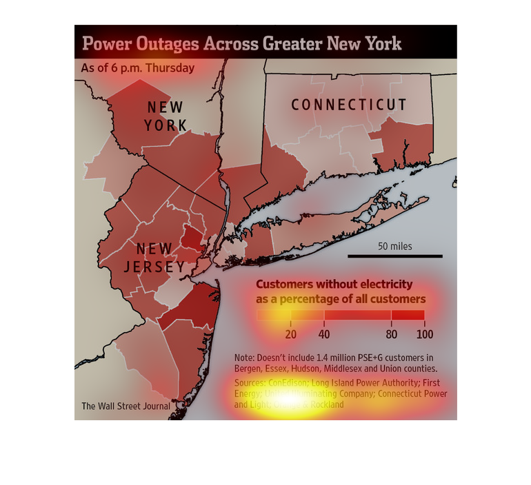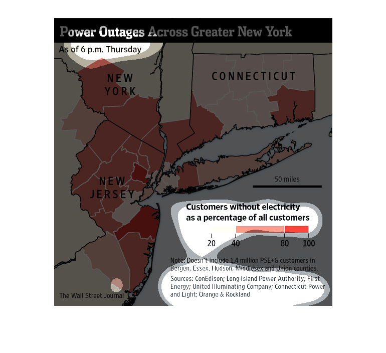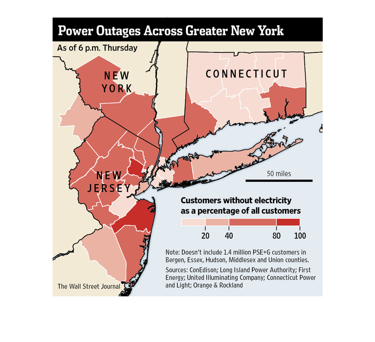
This graph is illustrating the amount of customers effected by power outages across the state
of New York. The data is seen as a percentage of all customers.
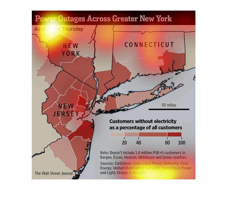
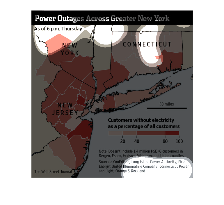
This chart from the Wall Street Journal shows how power outages are severe around New YOrk
and New Jersey as a result of Superstorm Sandy in 2012


This chart from the Wall Street Journal shows how the superstorm sandy in 2012 led to severe
power outages in new york city. This map shows where they were located
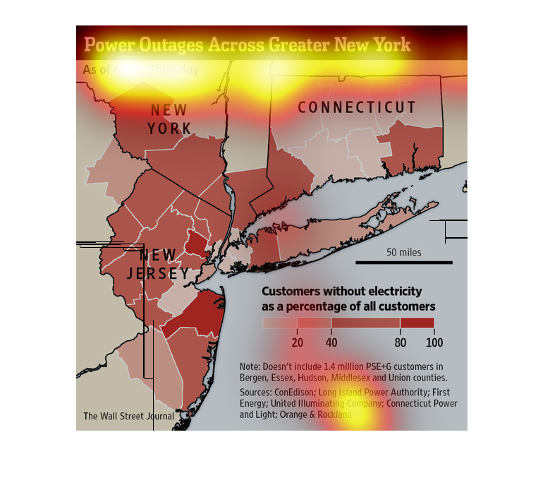
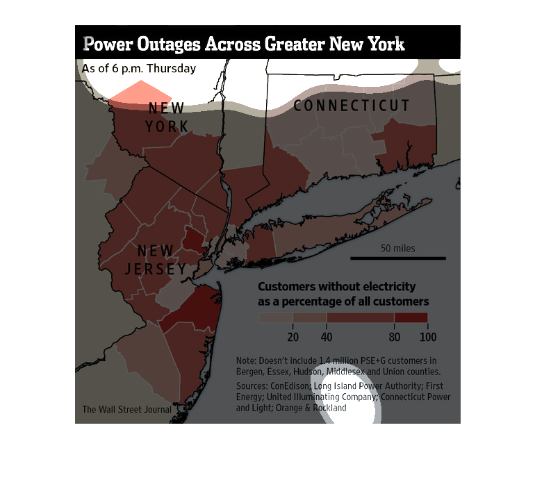
This is a picture  graph depicting  the power outage across different regains of the great
 New York  area it's not worded but it is depicted  nicely


This chart is a map of New York and it shows the power outages across the state. Based on
the red color of the states you can see the percent of customers without electricity versus
all the customers.
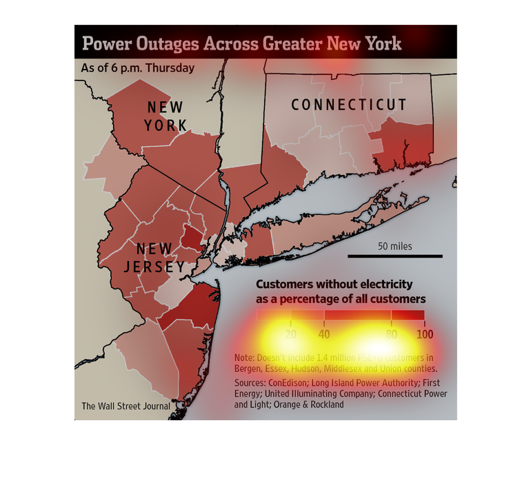
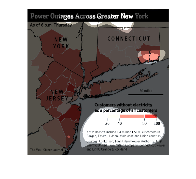
This chart represents the amount of power outage across New York.  It compares customers without
electricity to the percentage of all customers. There seems to be a higher concentration of
outages along coastal regions.

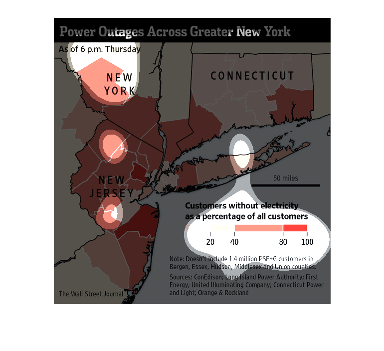
This chart describes the power outages around the greater New York area. It shows the percentage
of customers without power. The chart uses red for to show the areas and amount of people
with outages.

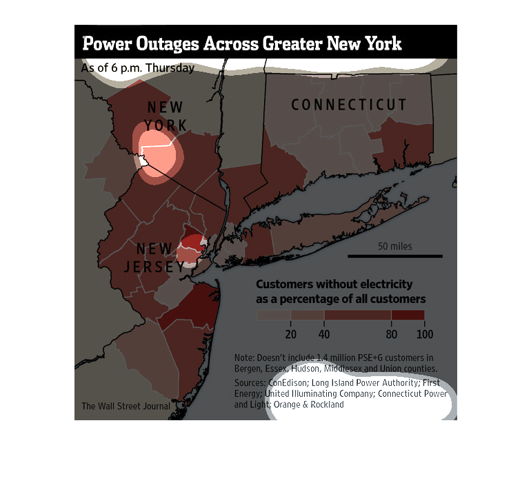
In this study conducted by the Wall Street Journal- from various listed sources- we see that
on a particular Thursday a great chunk of areas in New York, New Jersey, and Connecticut were
left without power.
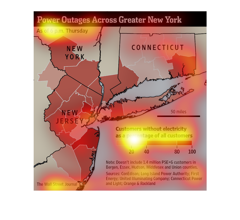
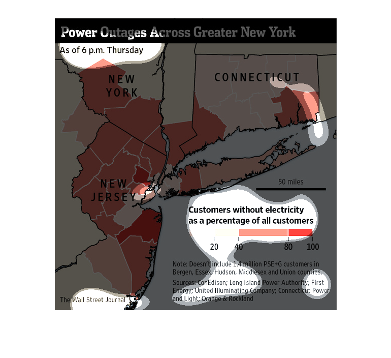
It is a map of the New Jersey/Conneticut/New York borders, showcasing areas where individuals
have been without power. It indicates in areas shaded by a light pink that a lower percentage
of people are affected, heading all the way up to a solid red, indicating areas with the most
percentages affected.
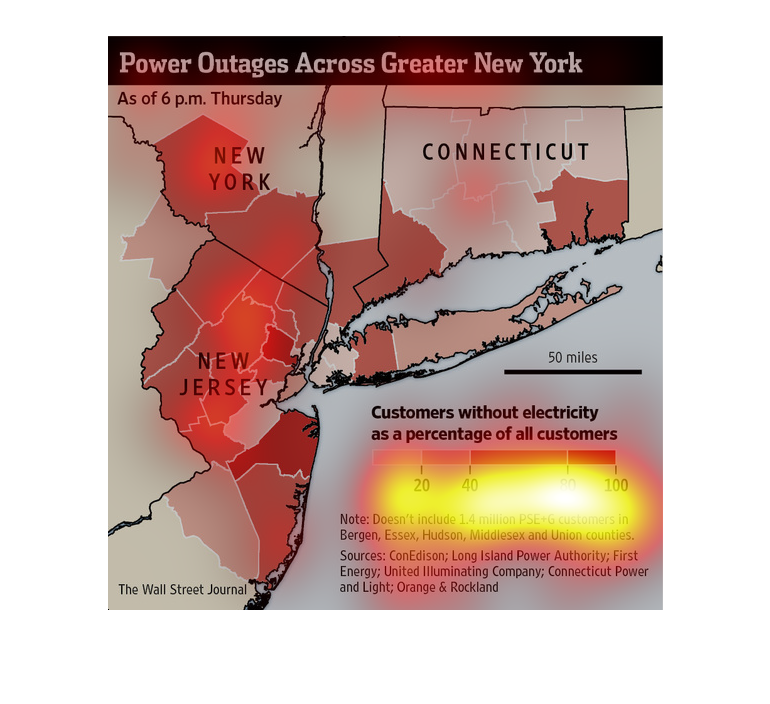
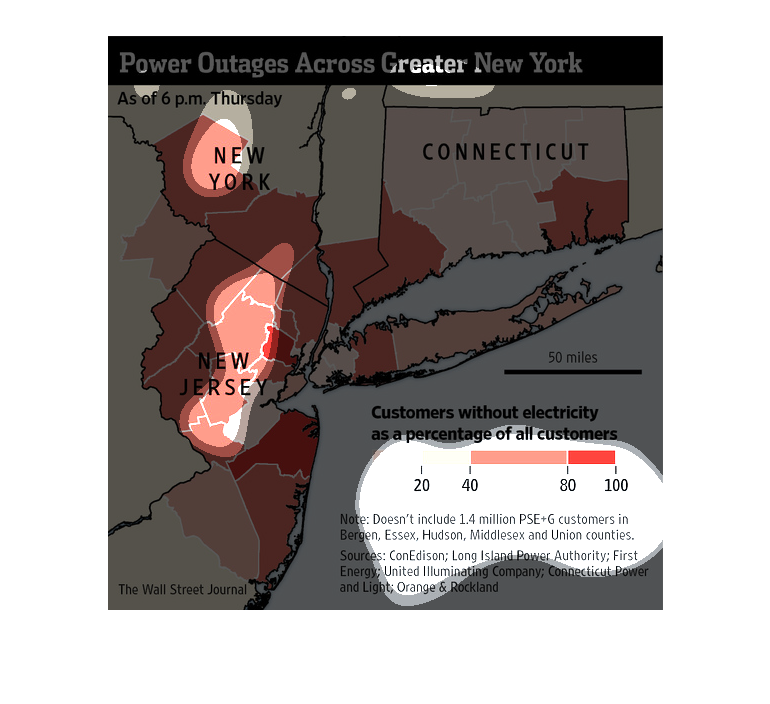
This chart shows a map that details the amount of customers without electricity within a given
time period. The region it shows is the east cost and New York
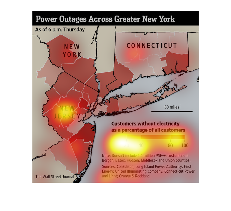
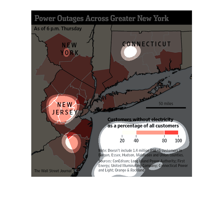
This is a graph of the amount of power outages going across New  York and New Jersey and Connecticut,
as of an undisclosed day and time. This also shows a bar graph of the amount of customers
affected.
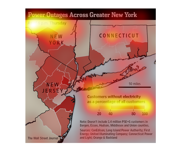
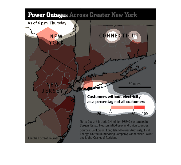
This image is entitled "Power Outages Across Greater New York."  It shows outages as of 6
p.m. on Thursday.  A large map shows New York, New Jersey, and Connecticut.   A graph depicts
customers without electricity as a percentage of all customers.  Sources are:  ConEdison;
Long Island Power Authority; First Energy; United Illuminating Company; Connecticut Power
and Light; Orange & Rockland.  The image appeared in The Wall Street Journal.
